
Arizona, Arizona, Arizona. Not only are you an incredible band (see: A R I Z O N A) but an incredible state, too. From the stunning canyons of the north to the rocky deserts of the south, Arizona is full of natural wonders. The best way, of course, to explore the epic terrain is by foot. When hiking around Arizona, there are a ton of different elements that must be taken into consideration before planning your trek. Mainly, the weather.
The scorching desert heat can restrict daylight exploring to the early mornings come the summer months. Always plan to have plenty of water in tow on any Arizona hike, no matter the temp or distance, due to the super dry climate. So long as you plan your hikes accordingly in the Grand Canyon State, you’ll be sure to spend your time outside soaking up the beauty rather than fixating on your lizard tongue.
The cactus-infused state has some of the most amazing and diverse hiking in the US, so I’m here to guide you toward the top hiking trails in Arizona by region. Whether it’s seeking shade and streams in Sedona or climbing a Joshua Tree-Esque terrain near Phoenix, here are the best hikes in Arizona - and no, Camelback didn’t make the cut.

Arizona Bucket List Hikes
Tom’s Thumb Trail (Scottsdale, AZ)
West Fork Trail (20 Mins North of Sedona)
Treasure Loop Trail (Lost Dutchman State Park)
Devil’s Bridge Trail (Sedona, ZA)
Grand Canyon South Rim Day Hike
PHOENIX AREA HIKES
TOM’S THUMB TRAIL

Location: Scottsdale, AZ, McDowell Sonoran Preserve
Distance: 4 miles
Route Type: Out & Back
Elevation Gain: 1,236 ft
AllTrails Difficulty Level: Hard
Water & Restrooms: No Water. Restrooms on site.
Cost: Free
This Arizona hike is known for its difficulty while in such close proximity to the Phoenix area, making it the perfect after-work escape or half-day adventure while visiting the area. With smooth, massive boulders reminiscent of Joshua Tree, pictures of Tom’s Thumb trail truly don’t do the views justice. The hike up to the top to Tom’s Thumb itself is a steep one. With over 1,000 feet in elevation gain, this climb will give your legs and booty a firm reminder of who's boss.

Tom’s Thumb is a really popular Arizona hike so if you’re heading out there on the weekend, be sure to get there on off hours to avoid the crowds. With that said, the parking is plentiful with an overflow lot along with a nice restroom and shaded area at the foot of the trail to cool off.
For those who find themselves exhausted hiking the switchbacks, there are a few different lookout points with stunning views of the far-off mountain ranges where you could turn around and still feel accomplished.
TREASURE LOOP TRAIL

Location: Lost Dutchman State Park, 45 Minutes from Scottsdale, AZ
Distance: 2.3 miles, can be longer by adding connected trails.
Route Type: Loop
Elevation Gain: 534 ft
AllTrails Difficulty Level: Moderate
Water & Restrooms: Water. Restrooms on site.
Cost: $7 on weekdays, $10 on weekends
Driving from the Phoenix area out to the Superstition Mountains will take you completely by surprise. The vast valley terrain is suddenly interrupted by the towering spires of Lost Dutchman State Park, making the time in the car worth it for the views alone. With that said, you can’t really go wrong with any hike at Lost Dutchman State Park. The Treasure Loop Trail isn’t too strenuous but rewards your raised heart rate with massive saguaro cactus and cliffs to match. You can easily add a mile or two onto this loop by extending on to a couple of the connected trails. This hike screams Arizona and is sure to blow your mind without too much travel time from the state’s capital.
SEDONA AREA HIKES
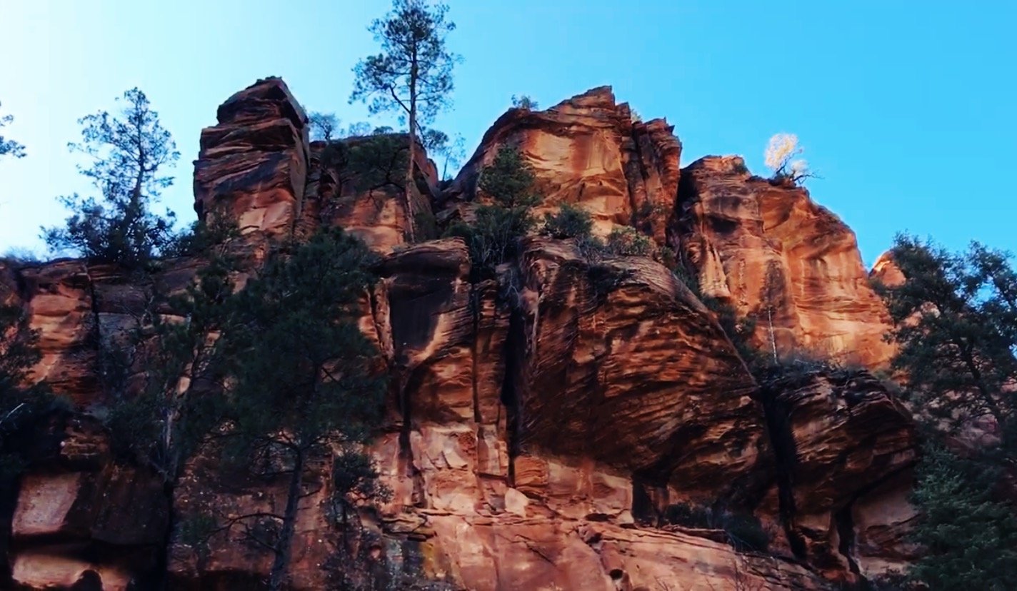
DEVIL’S BRIDGE TRAIL

Location: Sedona, AZ, Coconino National Forest
Distance: 3.9 miles
Route Type: Out & Back
Elevation Gain: 521 ft
AllTrails Difficulty Level: Moderate
Water & Restrooms: No Water. Restrooms on site.
Cost: Free
Upon arriving at the parking area designated for Devil’s Bridge Trail, you’ll realize that you can quickly add some distance to this hike if you’re not in a 4WD vehicle. After parking, you’ll have to walk along a pot-hole-ridden dirt road that would destroy a rental car - perhaps one of the major reasons its dune buggy central in this part of the national forest.
The hike to Devil’s Bridge definitely has some stair-like climbing to head up to the epic natural bridge. The sandstone structure perched at the top of the trail is actually the largest arch in the Sedona area, creating quite the outdoorsy tourist destination. It’s safe to say that there will even be a line for photos on the arch itself - and for good reason. Devil’s Bridge is a stunner and should be on the top of your Arizona hiking bucket list.
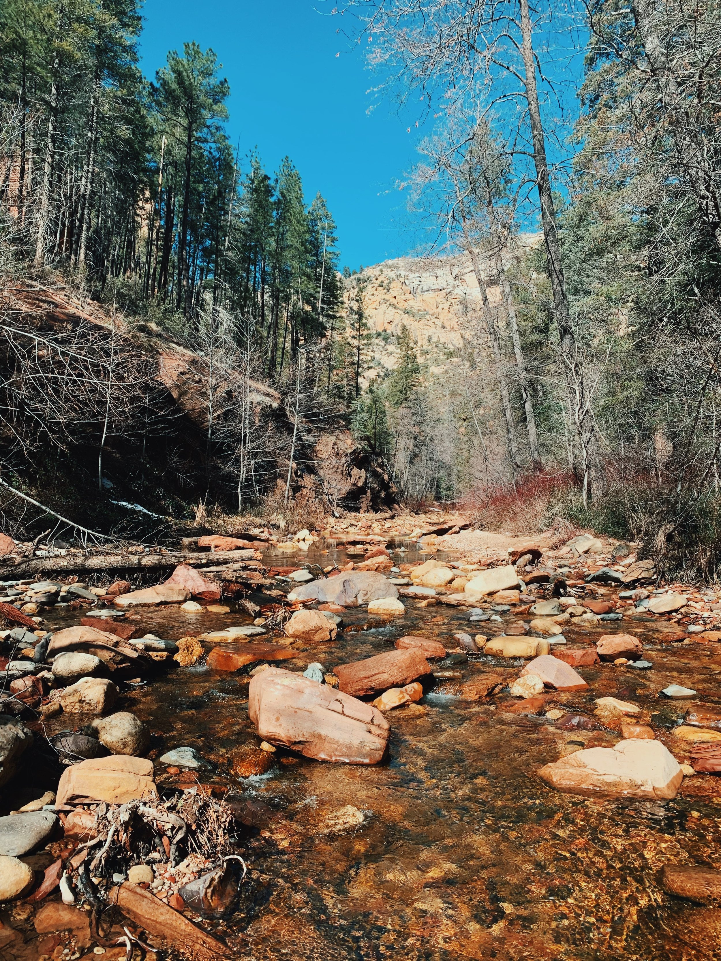
West Fork Trail
Location: Sedona, AZ, Coconino National Forest
Distance: 6.5 miles
Route Type: Out & Back
Elevation Gain: 564 ft
AllTrails Difficulty Level: Moderate
Water & Restrooms: No Water. Restrooms on site.
Cost: $12 per vehicle
West Fork trail is one of the most raved-about hiking trails by the Sedona locals due to its unique water features and celebrated shade. The trailhead is eleven-mile north of Sedona, clocking in at a twenty-minute drive from uptown. If you’re visiting West Fork in the colder winter months, you’ll feel like the $12 parking fee is a little steep. However, imagining the hike as a scorching summertime oasis, you’d be begging for access. With 13 river crossings in total, West Fork is a rare shady, swimming escape a stone’s throw from Sedona. We clocked in 7.2 miles in total with the lead into the trailhead and were thankful for our waterproof boots. In the warmer months, this hike is manageable in water shoes or Tevas.
SOUTH RIM HIKING AT THE GRAND CANYON
Most people tend to think only of the Grand Canyon as a jaw-dropping viewpoint and stick to the cement rim trail. Real adventurers looking to soak up the panoramic views from all vantage points have the opportunity to hike into the Grand Canyon from quite a few entry points. The southern rim is the most accessible area of the national park from any major airport. For those venturing to the more remote northern rim, be sure to monitor the National Park Service website when planning a trip due to closures during the winter months.
South Rim Grand Canyon Day Hiking Trails
The Bright Angel Trail (Day hike up to 12 miles round trip into the canyon.)
South Kaibab Trail (Access by shuttle bus, day hike up to 6 miles.)
For the most experienced of hikers looking for a real challenge, the Hermit Trail and Grandview Trail are two extremely difficult hiking trails along the south rim.


